

A rare tropical cyclone is heading towards Australia’s eastern coast, potentially bringing destructive winds and dangerous storm surges.
The tropical cyclone, named Cyclone Alfred, is expected to make landfall near Brisbane, Australia’s third most populous city, late on Friday or early on Saturday. It is the first cyclone to hit the city of 2.5 million people in over 50 years, raising concerns of severe flooding and damage in a region unaccustomed to direct cyclone impacts.
What is Cyclone Alfred?
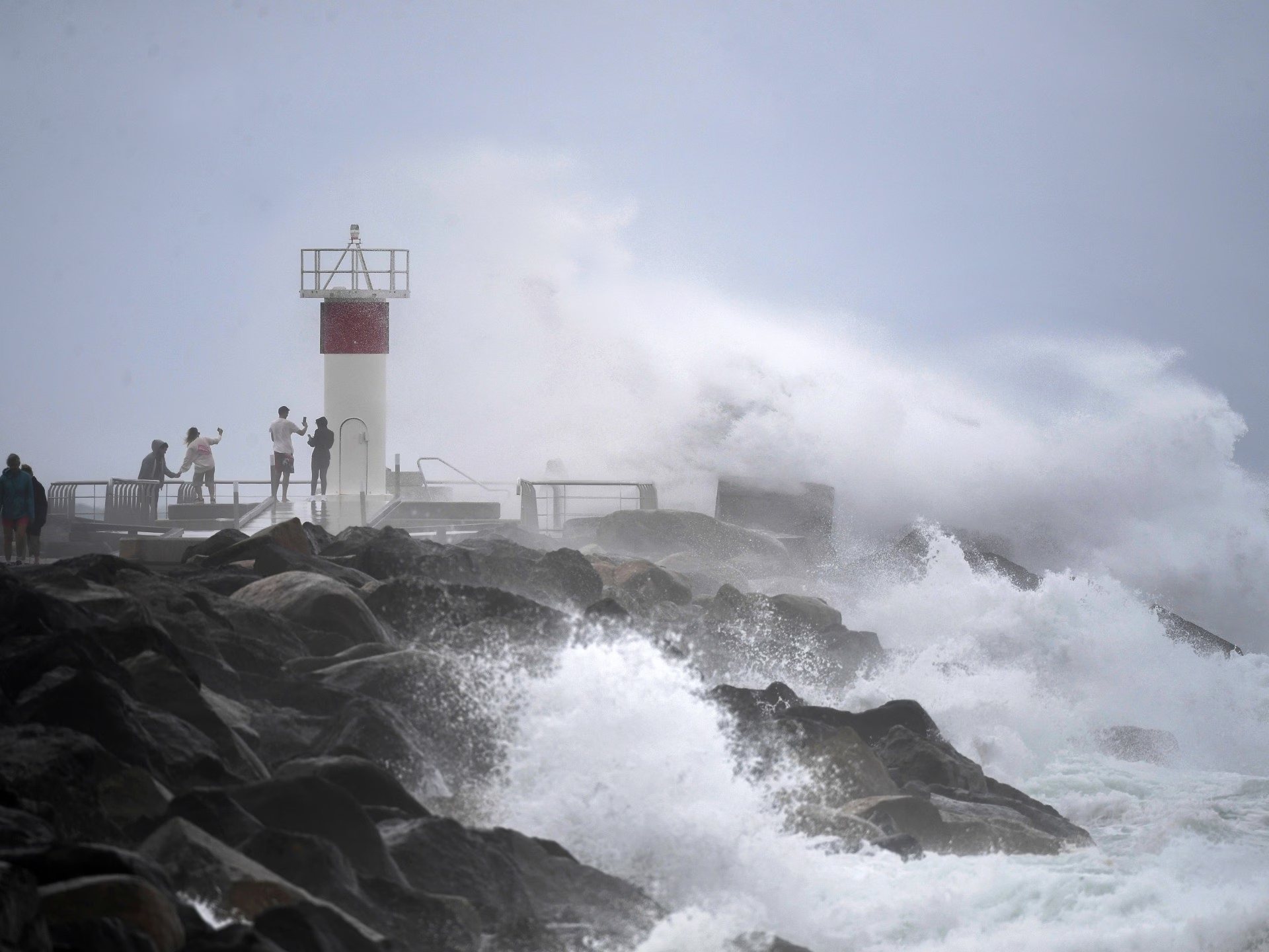
Cyclone Alfred is a Category 2 tropical cyclone barrelling towards the densely populated southeastern coast of the state of Queensland. Originating in the Coral Sea east of Australia, the storm made an unexpected U-turn in the Pacific Ocean and is now heading straight for the mainland, bringing destructive winds, heavy rain, and life-threatening storm surges.
The cyclone’s path could potentially hit densely populated areas unaccustomed to direct hits by cyclones. Cyclones typically form in tropical northern Australia, but Alfred is affecting the cooler central eastern coast – a rare occurrence. The last cyclone to impact Brisbane was Cyclone Zoe in 1974, which caused severe flooding.
When and where is Alfred expected to make landfall?
As of 08:54 GMT on Thursday, Alfred was positioned 225km (140 miles) east of Brisbane and 210km (130 miles) east-northeast of the Gold Coast, moving at a slow pace of 7 kilometres per hour (4 miles per hour), according to the Bureau of Meteorology.
The cyclone is forecast to hit land on Friday night or Saturday morning, between Brisbane and the Gold Coast, a region home to more than 3 million people.
Anticipated impact
Alfred is expected to hit the coast between Brisbane and the Gold Coast. Brisbane’s chief executive, Lord Mayor Adrian Schrinner, said up to 20,000 homes could experience some level of flooding.
Forecasters said Alfred’s impact will last for several days, with the worst weather expected from Thursday evening to Saturday morning. The effects may persist into next week. Alfred is currently classified as a Category 2 storm, meaning it has strong winds of 89 to 117km/h (55 to 73mph) capable of damaging homes, uprooting trees, and causing power outages. Heavy rains and dangerous storm surges are also forecast.
Public transport services and other closures
Public transport services in southeast Queensland will be significantly disrupted. All bus and train services have been suspended until further notice. Brisbane’s CityCat ferries have also stopped running due to dangerous conditions on the Brisbane River.
More than 700 schools in Queensland and northern New South Wales are closed from Thursday. Major airlines Qantas and Virgin have already cancelled flights, and the Gold Coast Airport is shut down from Wednesday afternoon.
What action are authorities taking?
Authorities have taken several measures to prepare for the impact of Cyclone Alfred. The government has provided 250,000 sandbags to residents in flood-prone areas of Brisbane and the Gold Coast. These sandbags can act as barriers to redirect water away from buildings and reduce flood damage. The military has also supplied 80,000 additional sandbags to areas at high risk of flooding. Evacuation centers are being set up across Queensland to provide long-term accommodation for residents whose homes become uninhabitable due to flooding or storm damage.
Source: https://www.aljazeera.com/news/2025/3/6/cyclone-alfred-where-when-is-it-expected-to-make-landfall-in-australia?traffic_source=rss