


While the world remains focused on the ongoing conflict between Israel and Hamas, Israel is swiftly reconfiguring the landscape of the occupied West Bank. Just two days after a ceasefire in Gaza on January 21, the Israeli military intensified its attacks across the West Bank, with bulldozers leveled entire residential zones and at least 40,000 people forcibly displaced from their homes. The Israeli forces have reintroduced tank invasions and air strikes in the West Bank, signaling a systematic approach to alter the region’s geographic identity and pave the way for full annexation.
A report from Al Jazeera’s fact-checking agency, SANAD, provides a detailed analysis of this situation, utilizing United Nations data, satellite imagery, and maps to illustrate the unfolding changes.
The occupied West Bank: An Overview
The West Bank, known as al-Daffah in Arabic, is situated west of the Jordan River and, together with occupied East Jerusalem, spans 5,655 square kilometers (2,183 square miles), approximately 15 times larger than Gaza or comparable in size to the US state of Delaware. Since 1967, Israel has militarily occupied the West Bank, subjecting Palestinians to checkpoints, arbitrary arrests, home demolitions, land seizures, settlement expansion, and frequent raids, severely restricting their daily lives.
The region is home to approximately 3.3 million Palestinians, segmented into 11 governorates, with Hebron as the most populous. In addition, around 700,000 Israeli settlers reside in unauthorized settlements on Palestinian territory.
Escalating Tensions Before October 7
Systematic data collection since 2008 reveals that Israeli forces and settlers have killed at least 1,896 Palestinians in the West Bank. By October 6, 2023, the death toll for the year had already surged to 198, marking it as the deadliest year on record at that time. The number of attacks has escalated since October 7, 2023, resulting in over 900 Palestinian deaths in the West Bank, with more than half occurring in Jenin and Tulkarem.
Why Target the Northern West Bank?
The northern governorates of Jenin and Tulkarem are the primary focus of Israel’s “Operation Iron Wall,” with fewer settlements and historical centers of Palestinian resistance. The region’s refugee camps have seen significant destruction, including the devastation of 205 structures in Tulkarem camp, 174 in Nur Shams camp, and 144 in Jenin camp. Since October 2023, settlement expansion has accelerated, with 48 new outposts established in 2024, even before the war.
Satellite Image Analysis
Satellite imagery analyses reveal extensive destruction and road bulldozing in Jenin, Tulkarem, and Noor Shams camp. The Israeli military has constructed 14 earthen barriers around Jenin camp, with military vehicles stationed near these barriers.
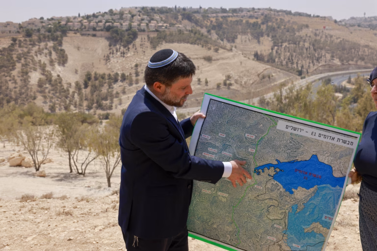
Demographic Concerns and Calls for Annexation
Despite rapid settlement expansion, Israel faces a demographic challenge, as the Palestinian birthrate remains higher. This has led to increased calls for annexation and displacement of Palestinians from strategically sensitive areas. Israeli officials and media figures advocate for the removal of Palestinians as both a security and humanitarian measure, while some academics see annexation as a significant Zionist achievement. However, security policy papers caution against unilateral annexation due to potential international isolation and the risk of a one-state reality where Jews could become a minority.
Source: https://www.aljazeera.com/news/2025/3/30/mapping-how-israels-land-grabs-are-reshaping-the-occupied-west-bank?traffic_source=rss