

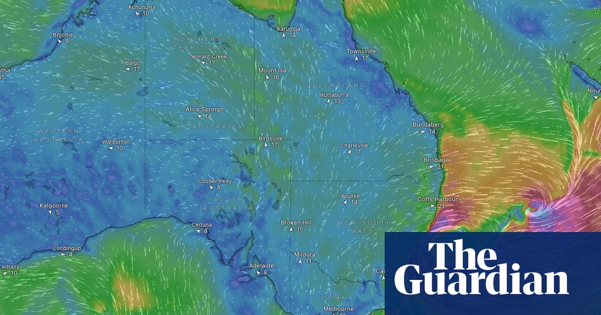
Sydney and parts of the New South Wales coast are preparing for a severe weather event expected to bring damaging winds, heavy rainfall, and flooding early next week, warns the Bureau of Meteorology. The forecast suggests flash and river flooding could occur in certain areas on Tuesday and Wednesday, with the Sydney metro area being particularly affected. The weather system, potentially developing into an east coast low known for its destructive impact, is expected to intensify significantly on Tuesday. Wind gusts of up to 100 km/h and rainfall between 100mm and 200mm over 48 hours are forecasted, raising concerns about both riverine and flash flooding, as well as the potential for widespread tree damage. The system’s rapid development, classified as a “bombing low,” is due to a quick drop in pressure, leading to an increase in wind speed and rainfall intensity. The weather event is currently predicted to start moving east by Thursday, with cooler than average temperatures expected to continue until early next week. Additionally, a band of cloud is forecasted to bring rainfall from the Gulf of Carpentaria to Queensland’s southeast over the weekend, affecting areas including Brisbane and the Gold Coast by late Sunday.
Source: https://www.theguardian.com/australia-news/2025/jun/28/torrential-rain-expected-to-hit-sydney-next-week-as-wild-weather-system-brews-off-australias-east-coast
Heavy rain forecasted for Sydney next week due to intense weather system developing on Australia’s east coast | Australian weather update
You May Also Like


Trump Indicates Likely Near-Term Gaza Truce, Provides No Further Information